
Creating data-rich “digital twins” of real-world spaces with LiDAR technology.

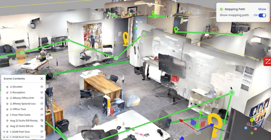
LiDAR scan in the ARway Creator Portal.
Measuring and mapping physical space has been a human activity for almost as long as we’ve been human. The array of approaches and technologies that have been used is absolutely amazing. From the Bronze Age Saint-Belec Slab to Ptolmey’s world map to the geodesic triangulation of Cassini to aerial maps created by the US Army Balloon Corps during the Civil War to modern GPS, our species have been mapmakers for an awfully long time.
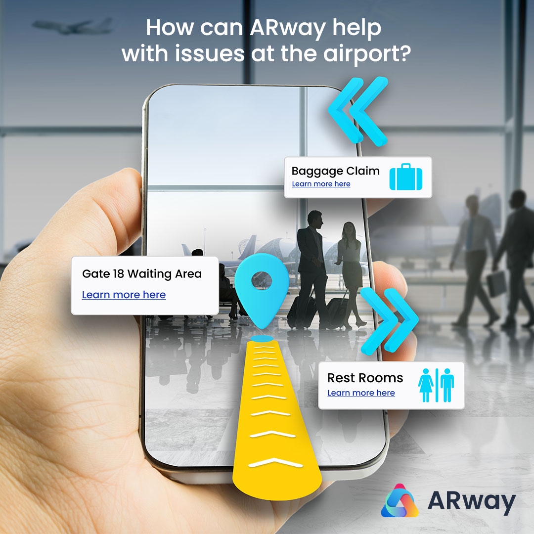
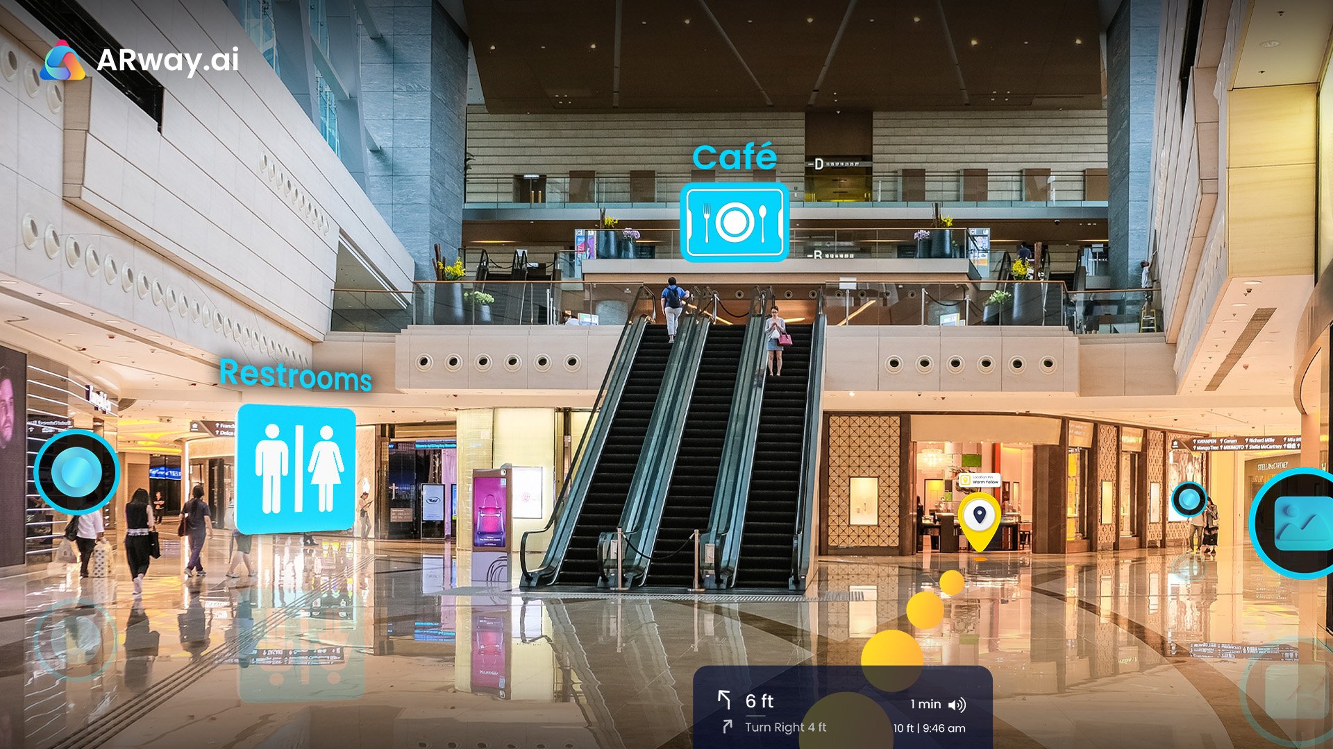
Now that each of us carries what is essentially a real-time atlas in our pockets, finding one’s place in the world has never been easier. Finding your way around dynamic, indoor spaces – like a cavernous conference center, a bustling medical center, or a museum with regularly changing exhibits? That’s a little harder, but it’s exactly the problem we set out to solve with ARway, which connects the physical and digital worlds with augmented reality, wayfinding and no-code spatial maps.
One of the cool technologies that makes this modern miracle possible is light detection and ranging, commonly referred to as LiDAR. LiDAR is a technique for measuring and recording distances by firing a laser at an object and recording how long it takes for the light to be reflected back to a sensor.
LiDAR is one of the most effective methods to generate rich information about the surface of the surrounding environment and construct accurate 3D models, which has a million applications.
Of course, LiDAR isn’t the only available method for providing accurate representations of the world. Let’s examine a few of the available alternatives, shall we?
- Wi-Fi is almost ubiquitous in indoor spaces at this point, it is not universally. To function most effectively, multiple access points are required, not a certainty in every situation.
- Bluetooth Low Energy (BLE) beacons are another popular approach. The challenge with this approach is the need for beacons to be mounted at various points in space, adding to the cost and complexity of deployment.
- Finally (at least for the moment) comes Ultra-Wideband (UWB). The downside here is the requirement that anyone wishing to use a UWB-powered experience will need to carry a special tag because current smartphones don’t have UWB-compatible hardware.
At one point, LiDAR scans themselves could only be created with professional and costly instruments, including scanners, lasers, and GPS receivers. Luckily, recent innovations made on consumer devices mean people can harness this powerful technology directly from their phones.
At ARway, we are always seeking new and better ways to map and present the world. After a careful evaluation, it became clear that LiDAR was the optimal solution. LiDAR really does permit us to do amazing things. At the top of the list is the ability to create hyper-accurate “meshes” that allow us to create high-quality spatial mapping solutions. Our use of the technology – and the impact it has for our customers – has helped secure our leadership in the expanding wayfinding and spatial computing market.
LiDAR in the ARway Creator Portal
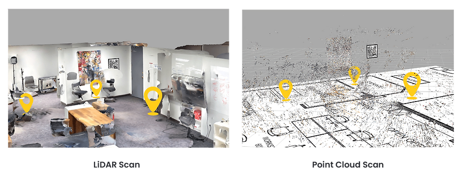
LiDAR allows ARway to create data-rich “digital twins” of real-world spaces. These can be used in our Map Studio Portal, as well as for creating far more accurate geospatial datasets than can be achieved using the standard point-cloud approach or any of the alternatives described above.
LiDAR has a wide range of real-world applications that help it make ARway a perfect fit in a variety of use cases. Realtors, for example, can present spaces with far greater fidelity than in the past. Those spaces can also be populated with persistent data that people can access by scanning a QR code to enter a hidden world of information, such as wayfinding, AR advertising, and entertainment.
When it comes to connecting places with information, there is no more powerful tool than ARway. LiDAR provides the foundation for this amazing capability. If your business depends on connecting people with physical spaces, ARway is unmatched. To learn more about how LiDAR can make your business more successful, contact us here.